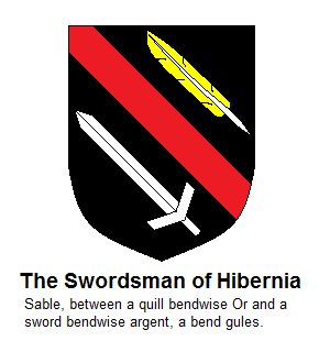
(Why did I pick that name? That is a stupid name. Sounds like the dullest Time Lord that ever was.)
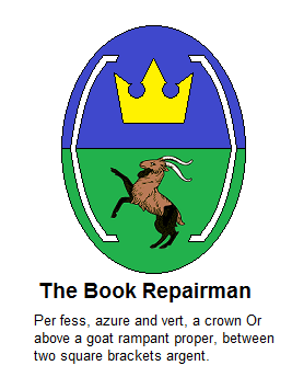
Per fess, azure and vert, between two enclosing brackets, argent, a crown, Or, above a goat, proper.
To be clear, that's a blue-over-green background, with white [brackets] on either end. A (preferably) black-and-brown goat on the green field, and a gold crown over the blue. (Specifically, a crown shaped like this, if possible:

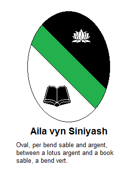
Also, I would like one of the oval, lady-shields to be contrary and difficult forward-thinking and stereotype-breaking.
And now, a short story (I just kind of throw these down at the drop of a hat, anymore, don't I?):
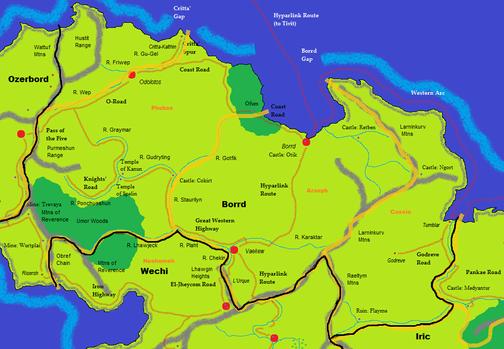
The Book Repairman walked stealthily and warily down the corridors of the castle, the smell of goats following ever after as he passed another scrawling of "CANT" upon the walls. He had spent many weeks in this castle, near a port in El-Jheycom, seeking the fragmented stories of Kippur, called the Bird.
Long ago, the Bird had been a knight of Plort, wielding many weapons against the Marizu: Verra, a mighty launcher of enchanted flame; Lorac, the magic wand; and a mysterious weapon marked "C." But best known of Kippur's weapons was a strange siege engine, the Alexander. The Alexander carried strange cloaking magics, which Kippur used to infiltrate many lands, both in Weab and in the Scholar's Empire. Mostly, these were missions of observation, and exploration, but the Bird had not been afraid to wage war on many of the more slovenly states, whether dominated by Marizu or not: most famously, the Inherited Cities.
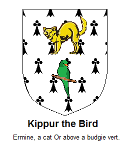
Many of Kippur's campaigns against the Marizu had departed from this castle; indeed, the Repairman had entered through the storage region for the weapons from thos long-ago sieges. They had been largely abandoned, with the remains of the flame-launcher Verra long ago left destroyed, and beyond use. Still, records lived on in small pieces, and the search led the archaeologist into the still-thriving section of the Bird's castle. Here, where the Bird's heraldry of cat, Or, and budgie, vert, still lined the walls, bright and tended, the Book Repairman continued with much caution, for signs of fresh preparation lay everywhere. Kippur was readying his possessions for travel into the lands of the Scholar's Empire permanently, with a newer and more robust version of the Alexander, ready to form a nation of his own.
The Repairman had no desire to intrude, only pausing to find more mentions of the Bird's days as a knight. Even here, where the time of Plort seemed long forgotten, some small signs of Kippur's knighthood yet lingered. And these signs led to yet another wing of the castle, unknown previously, where small memoirs of the knight and his weapons yet lingered. Those these were not the tales of campaigns the Book Repairman had set out to find, he rejoiced! for the statue of the Bird in Wechi could soon be added to, and made larger, that all the denizens of Plort would know more of the tales of Kippur the Knight!
So, uh, yeah. This has been my "journey" through Kippur's LJs, still ongoing. I know this is a little weird, buuuuuut I was working on Kippur's stuff just before I started designing my herald, so it was quite on my mind. I intended this to be more about my character at the start, but it evolved more into being about Kippur. But that's fine, I think; he's not here to write it himself, after all.
Some references that may not be obvious:
*Kippur had three LJs, hence the three wings to his El-Jheycom castle. (His personal one, his writing one, and the IC-Alec one. Actually he had IC journals for a ton of other characters, too, but let's not go nuts, here.)
*The flamethrower (did I make that sound fantasy enough?) Verra is destroyed because Agent Verra is, actually, dead. It happened outside the PPC, in an RP with another community, but it seems to have applied to our Verra, too. So sad face there.
*The herald contains two of Kippur's pets, a cat and a budgie. (The bird was a present to his mother for Yom Kippur, hence "Kippurbird." What? No, I wasn't reading the personal entries! Intentionally. >> It was about animals! I couldn't help it!) He also had a fish he was quite fond of, but I felt the sentence was getting way too long.
*"CANT" stands for "Cure All Neuro-Typicals." Kippur used to sell merchandise with this saying to counter the well-meaning-but-ultimately-insulting CAN: Cure Autism Now. Sadly, the store he sold that stuff through seems to be down now. :(
*And, of course, as the wiki has said for years, Alec and Lorac (but no longer Verra) are set appear in their own series of novels, which Kippur will hopefully publish. Which I can't wait for, because I feel like I've already read half of it from the writing samples he wrote over the years. Incidentally, Kippur already has a non-fiction book available for pre-order (coming out mid-December), which I plug here, that we may send monies to our esteemed colleague: <a href="http://www.amazon.com/Tropes-Fantasy-Fiction-Gabrielle-Lissauer/dp/0786478586/ref=sr11?s=books&ie=UTF8&qid=1408682053&sr=1-1">http://www.amazon.com/Tropes-Fantasy-Fiction-Gabrielle-Lissauer/dp/0786478586/ref=sr1_1?s=books&ie=UTF8&qid=1408682053&sr=1-1
Also and finally, sharing a video I saw today about fandom shipping. Not safe for brain: https://www.youtube.com/watch?v=iIXBuoFF4Ns


